"A path is a prior interpretation of the best way to traverse a landscape”
(Rebecca Solnit, Wanderlust: A History of Walking)
(Rebecca Solnit, Wanderlust: A History of Walking)
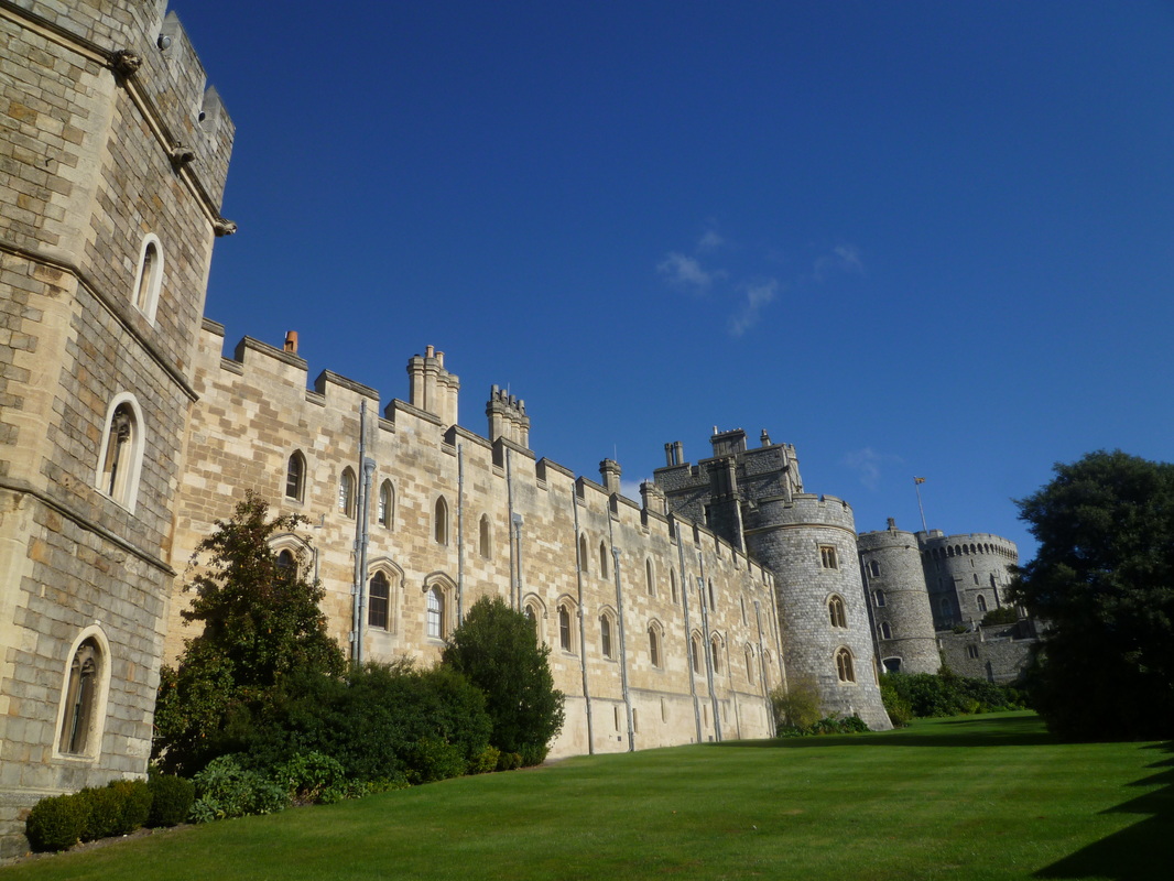
Windsor Castle (Section 1)
|
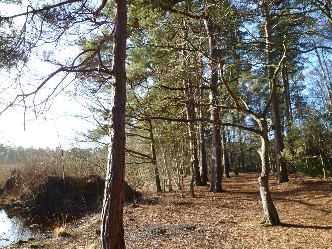
Englemere Pond (Section 2)
|
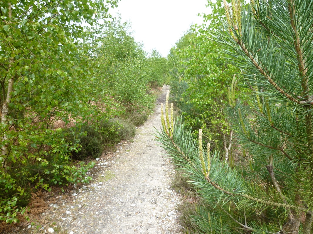
Warren Heath (Section 3)
|
The Three Castles Path
This path is based on the 13th century travels of King John between Windsor and Winchester. Odiham Castle, located at the halfway stage, was built for King John and provided a convenient resting place. The total route is about 60 miles long and takes the walker through varied scenery and points of interest, including royal parks, heath and woodlands, canal and riversides, historic towns and pretty villages, and the North Downs.
Section 1: Windsor Castle to Ascot
Section 2: Ascot to Sandhurst
Section 3: Sandhurst to Winchfield
Section 4: Winchfield to Ellisfield
Section 5: Ellisfield to Itchen Abbas
Section 6: Itchen Abbas to Winchester
Photos
Verdict: I completed this walk between October 2016 and September 2017 with walk section completed in each season. That added to the variety of this relatively short but worthwhile walk. Walking was easy and the little guidebook published by the East Berkshire Ramblers proved invaluable. However, I would strongly advise anyone attempting the walk to also have either the relevant maps or electronic equivalent.
The biggest challenge was getting to some of the start and end points. Buses are at best patchy and at worst non-existent (no point even trying to do sections 3-5 on a Sunday unless you are prepared to add lots of extra miles to the walk by walking, e.g. from Ellisfield to Basingstoke). It was a challenge I enjoyed!
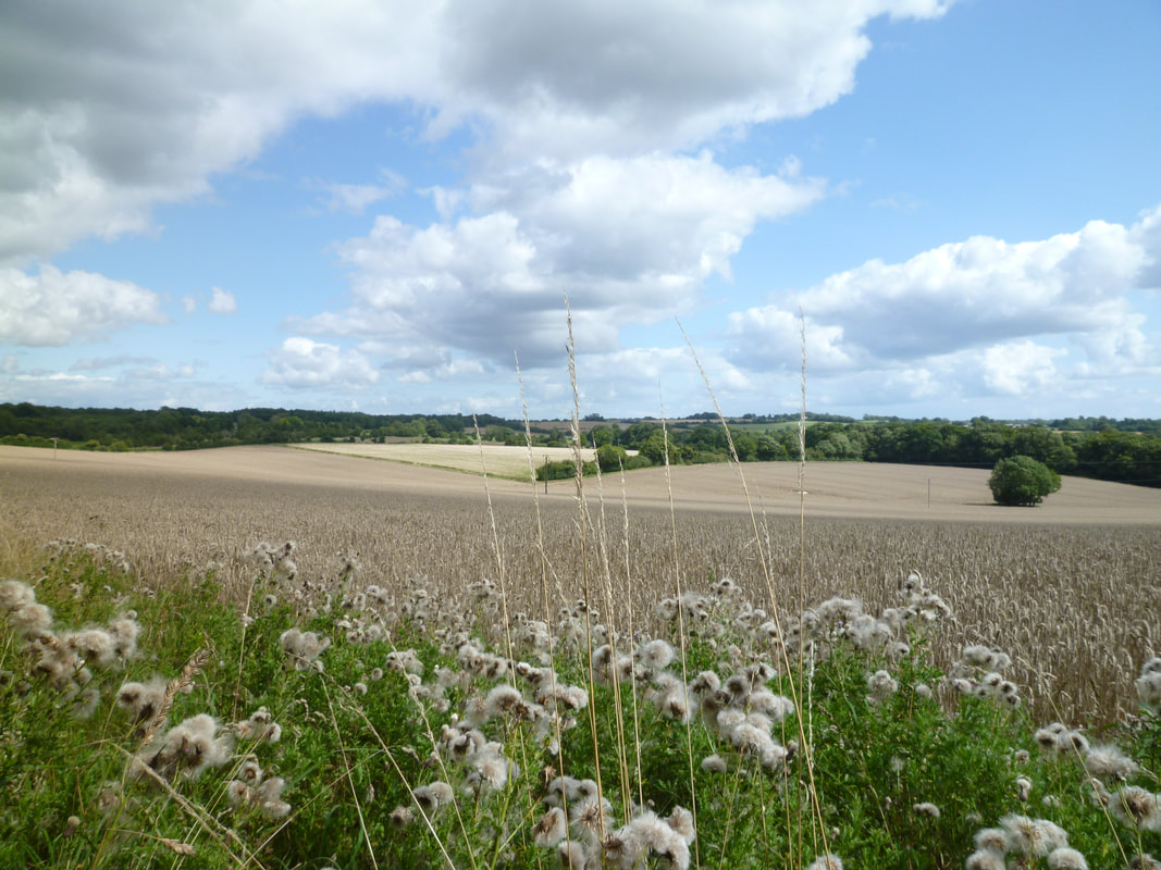
For me the highlights of the walk were Windsor and Winchester (for obvious reasons), Odiham Castle, walking along the Basingstoke Canal and the River Itchen, some lovely downland walking with extensive views, and the beautiful villages, particularly on the final section. Anyone planning to solo walk this route should be aware that you will sometimes walk for miles without seeing another human being!
Maps/Guidebooks
The Three Castles Path (published by the East Berks Ramblers Group)
Ordnance Survey Map Explorer 160 (Windsor, Weybridge & Bracknell)
Ordnance Survey Map Explorer 159 (Reading, Wokingham & Pangbourne)
Ordnance Survey Map Explorer 144 (Basingstoke, Alton & Whitchurch)
Ordnance Survey Map Explorer OL 32 (Winchester)
Links
East Berkshire Ramblers
Section 1: Windsor Castle to Ascot
Section 2: Ascot to Sandhurst
Section 3: Sandhurst to Winchfield
Section 4: Winchfield to Ellisfield
Section 5: Ellisfield to Itchen Abbas
Section 6: Itchen Abbas to Winchester
Photos
Verdict: I completed this walk between October 2016 and September 2017 with walk section completed in each season. That added to the variety of this relatively short but worthwhile walk. Walking was easy and the little guidebook published by the East Berkshire Ramblers proved invaluable. However, I would strongly advise anyone attempting the walk to also have either the relevant maps or electronic equivalent.
The biggest challenge was getting to some of the start and end points. Buses are at best patchy and at worst non-existent (no point even trying to do sections 3-5 on a Sunday unless you are prepared to add lots of extra miles to the walk by walking, e.g. from Ellisfield to Basingstoke). It was a challenge I enjoyed!
For me the highlights of the walk were Windsor and Winchester (for obvious reasons), Odiham Castle, walking along the Basingstoke Canal and the River Itchen, some lovely downland walking with extensive views, and the beautiful villages, particularly on the final section. Anyone planning to solo walk this route should be aware that you will sometimes walk for miles without seeing another human being!
Maps/Guidebooks
The Three Castles Path (published by the East Berks Ramblers Group)
Ordnance Survey Map Explorer 160 (Windsor, Weybridge & Bracknell)
Ordnance Survey Map Explorer 159 (Reading, Wokingham & Pangbourne)
Ordnance Survey Map Explorer 144 (Basingstoke, Alton & Whitchurch)
Ordnance Survey Map Explorer OL 32 (Winchester)
Links
East Berkshire Ramblers
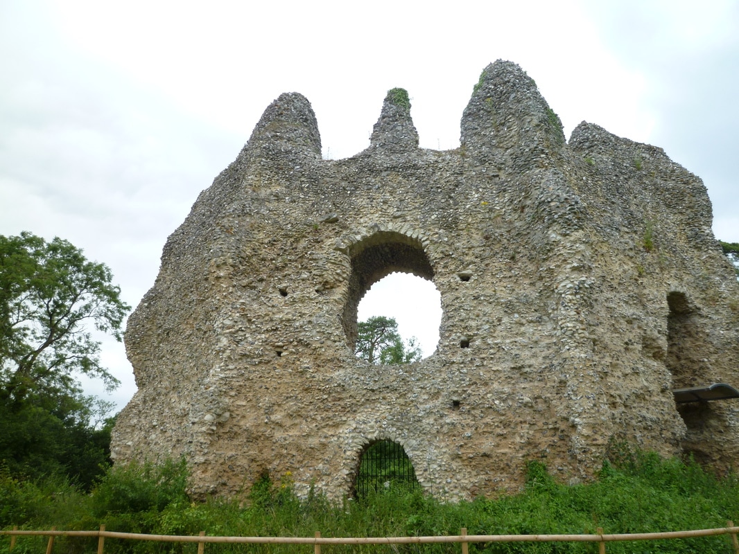
Odiham Castle (Section 4)
|
View from Godsfield Copse (Section 5)
|
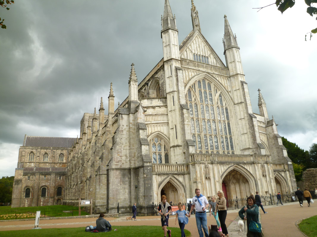
Winchester Cathedral (Section 6)
|