North Downs Way
Chantry Wood
|
St Martha's Church
|
Guildford to Dorking
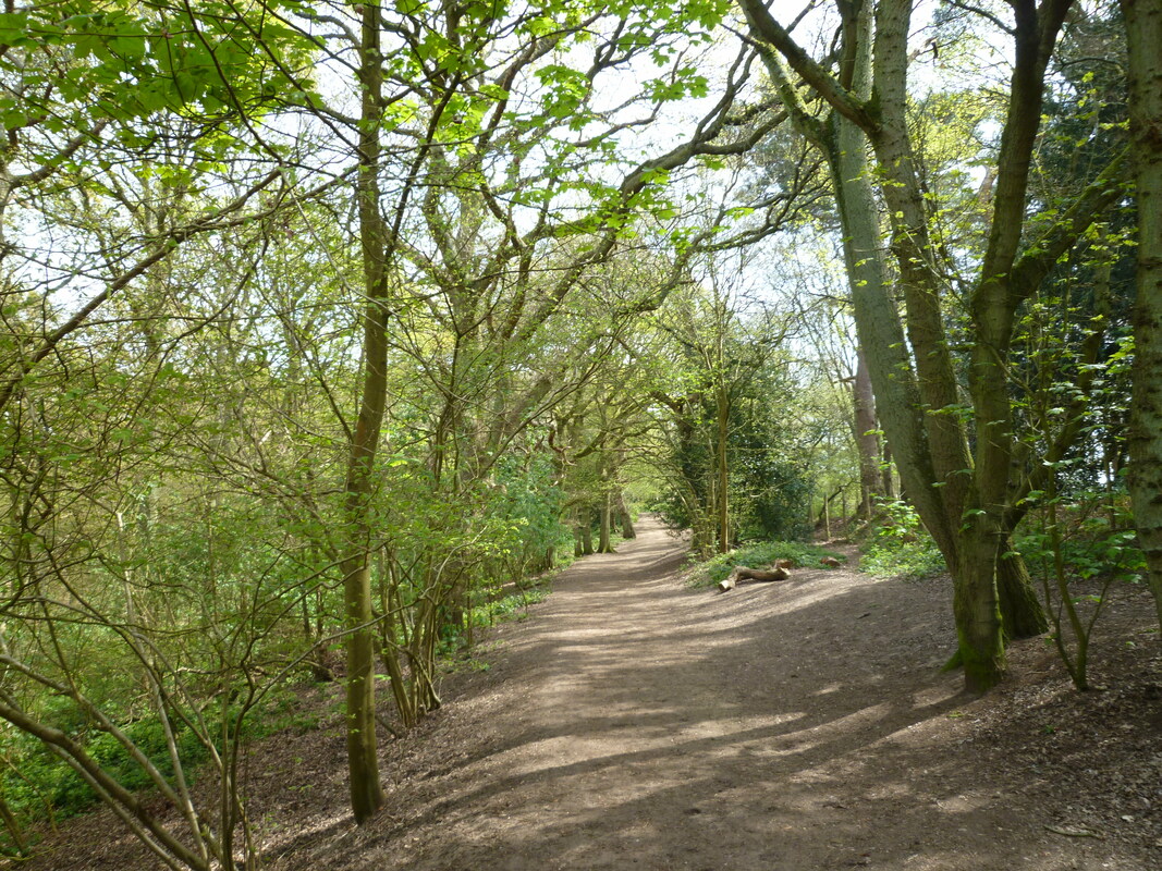
 Little King's Wood
Thursday 18 April 2019
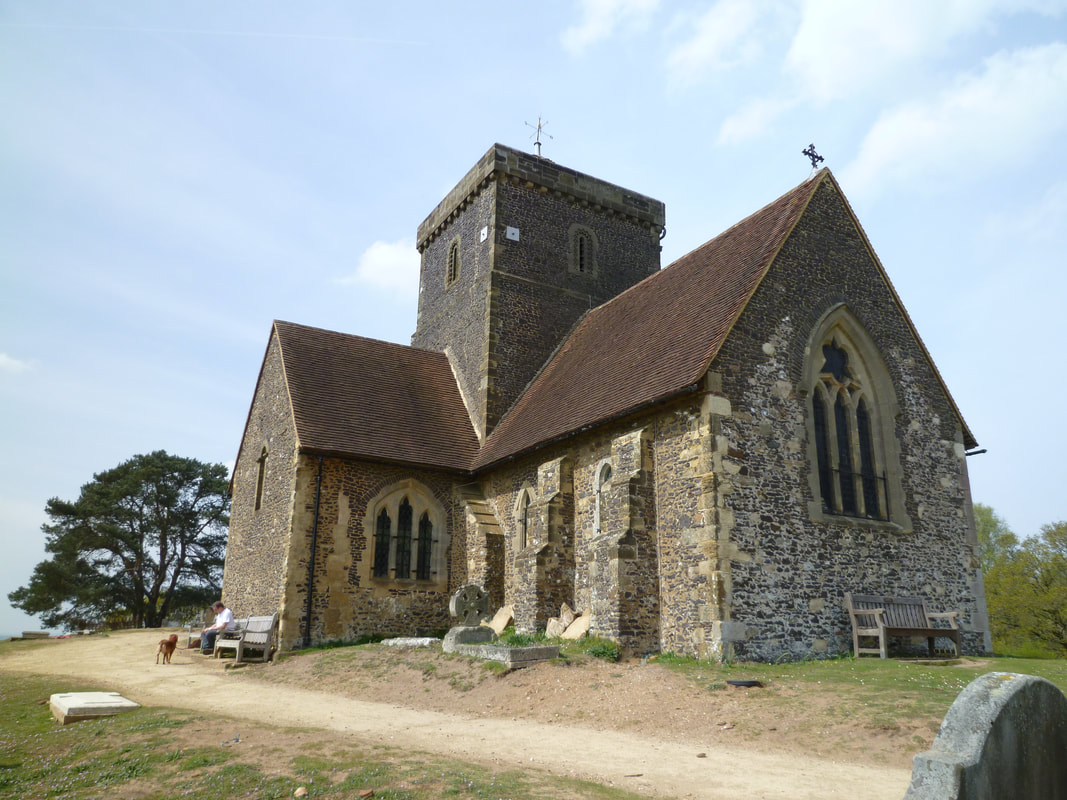
Making the most of the unusually warm weather and extra time off work before the Easter weekend by returning to Guildford and walk the next leg of the North Downs Way. There was not a cloud in sight when I walked along the River Wey Navigation to rejoin the trail. Before crossing the river I walked up Ferry Lane and then steeply uphill on a footpath to visit the ruined remains of St Catherine’s Chapel. After retracing my steps downhill to the river and crossing to the other side on the wooden bridge, the path continued on a grassy track across Shalford Park and then leaves Guildford on the Pilgrims Way. Having followed this road for a while I was pleased when the trail left the road and I soon enjoyed walking in the shade of Chantry Wood. Although the official path is on a gravel track alongside the forest, there is parallel footpath just inside the woods – much more pleasant on a dry and warm day. The path climbed gently but steadily uphill and every now and again a fine view opened up northwards to Pewley Down. After leaving Chantry Wood on reaching Halfpenny Lane a delightful sandy path leads uphill to the top of St Martha’s Hill and St Martha’s Church. On the top of the hill there are panoramic views towards the Greensand Ridge in the South and West and Guildford and the Wey Valley (North and East). However, the atmosphere today was quite hazy and that really dulled the views.
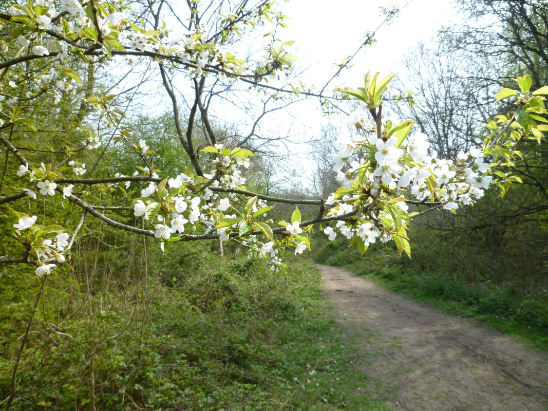
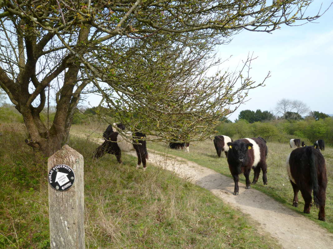
I stopped to eat a sandwich on a bench by the church and then left the churchyard by the Yvonne Arnaud memorial stone. The ashes of the French actress after whom the theatre in Guildford was named were scattered somewhere on St Martha’s Hill. This sandy heath and woodland is now a nature reserve where adders might be seen (I looked but was unlucky). The trail now makes its way downhill and leaves the sandstone hill to head northwards towards Albury Downs. After reaching the top of these typical North Down chalk hills the path continues eastwards on a wonderful grassy path by the woodland edge with more great views to the hills further south to soon reach Newlands Corner. Here there is a café, car park and plenty of people! I bought a take-away coffee (having remembered to bring my reusable mug!) and shortly entered the woodland through which I would now be walking for a few miles. I enjoyed the cool stillness and solitude of walking in the woods. The only sounds were birdsong and the occasional rustling on the forest floor that needed investigating. Among the blackbirds and squirrels I spotted a mouse. Woodland spring flowers were also a constant delight. Eventually the trail turns right to pass Hollister Farm and then re-enters woodland to continue along a track called the ‘Canadian Road’ – named after the Canadian soldiers who prepared here for the 1944 Normandy invasion. After what seemed an age the path at last left the woods at the NT Hackhurst Down and views opened up southwards to the High Weald. After a brief delay trying to get past a herd of longhaired cattle who insisted on walking very slowly across my track there now followed the best walking of the day. The open views and lovely path on chalkland grass on the edge of woodland were a delight. As I re-entered woodland, the warm day seemed to have hastened the bluebell flowering process. When the path emerged from the woods there was another NT site, Steer’s Field, with views now towards Dorking. After walking through Ranmore Common, the path now made its way towards the extensive vineyard of Denbies.
I left the North Downs Way where the Mole Gap Trail crosses it and followed this trail through the vineyard to Dorking where this section ends.
Making the most of the unusually warm weather and extra time off work before the Easter weekend by returning to Guildford and walk the next leg of the North Downs Way. There was not a cloud in sight when I walked along the River Wey Navigation to rejoin the trail. Before crossing the river I walked up Ferry Lane and then steeply uphill on a footpath to visit the ruined remains of St Catherine’s Chapel. After retracing my steps downhill to the river and crossing to the other side on the wooden bridge, the path continued on a grassy track across Shalford Park and then leaves Guildford on the Pilgrims Way. Having followed this road for a while I was pleased when the trail left the road and I soon enjoyed walking in the shade of Chantry Wood. Although the official path is on a gravel track alongside the forest, there is parallel footpath just inside the woods – much more pleasant on a dry and warm day. The path climbed gently but steadily uphill and every now and again a fine view opened up northwards to Pewley Down. After leaving Chantry Wood on reaching Halfpenny Lane a delightful sandy path leads uphill to the top of St Martha’s Hill and St Martha’s Church. On the top of the hill there are panoramic views towards the Greensand Ridge in the South and West and Guildford and the Wey Valley (North and East). However, the atmosphere today was quite hazy and that really dulled the views.
I stopped to eat a sandwich on a bench by the church and then left the churchyard by the Yvonne Arnaud memorial stone. The ashes of the French actress after whom the theatre in Guildford was named were scattered somewhere on St Martha’s Hill. This sandy heath and woodland is now a nature reserve where adders might be seen (I looked but was unlucky). The trail now makes its way downhill and leaves the sandstone hill to head northwards towards Albury Downs. After reaching the top of these typical North Down chalk hills the path continues eastwards on a wonderful grassy path by the woodland edge with more great views to the hills further south to soon reach Newlands Corner. Here there is a café, car park and plenty of people! I bought a take-away coffee (having remembered to bring my reusable mug!) and shortly entered the woodland through which I would now be walking for a few miles. I enjoyed the cool stillness and solitude of walking in the woods. The only sounds were birdsong and the occasional rustling on the forest floor that needed investigating. Among the blackbirds and squirrels I spotted a mouse. Woodland spring flowers were also a constant delight. Eventually the trail turns right to pass Hollister Farm and then re-enters woodland to continue along a track called the ‘Canadian Road’ – named after the Canadian soldiers who prepared here for the 1944 Normandy invasion. After what seemed an age the path at last left the woods at the NT Hackhurst Down and views opened up southwards to the High Weald. After a brief delay trying to get past a herd of longhaired cattle who insisted on walking very slowly across my track there now followed the best walking of the day. The open views and lovely path on chalkland grass on the edge of woodland were a delight. As I re-entered woodland, the warm day seemed to have hastened the bluebell flowering process. When the path emerged from the woods there was another NT site, Steer’s Field, with views now towards Dorking. After walking through Ranmore Common, the path now made its way towards the extensive vineyard of Denbies.
I left the North Downs Way where the Mole Gap Trail crosses it and followed this trail through the vineyard to Dorking where this section ends.
My highlights:
Transport:
- St Martha’s Hill and Church
- Views from the North Downs
- Walking on Albury Down, Hackhurst Down, Blatchford Down and Steer’s Field
- Horses, sheep and cattle
- Birds
- Squirrels, rabbits, and a mouse
Transport:
- Train Reading to Guildford
- Return: (slow) train West Dorking to Reading (with hindsight should have walked to Dorking Deepdene)
- Guildford
- Newland’s Corner (Café)
- Dorking
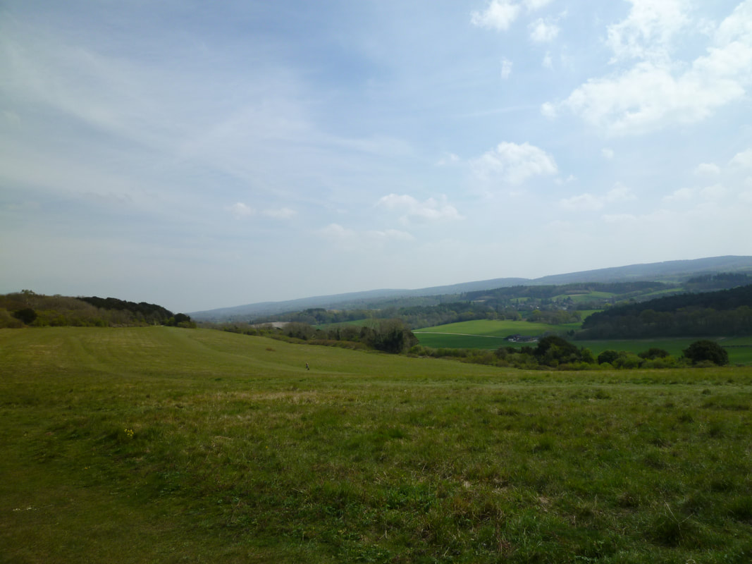
View from Albury Downs
|
Obstruction on Blatchford Downs
|