Wayfarers' Walk
Resuming the walk at Widley
|
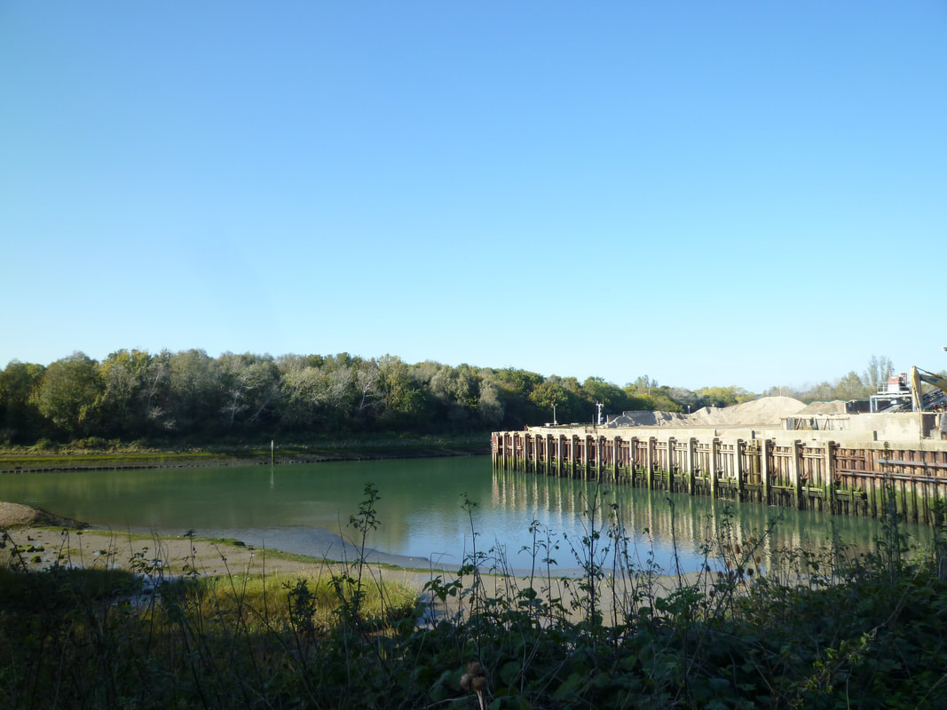
Weir at Brockhampton
|
Widley (Cosham) to Emsworth
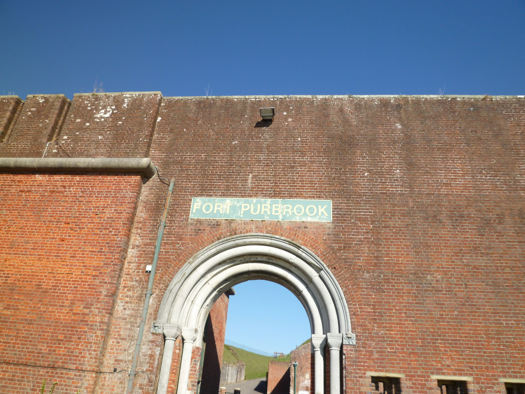 Fort Purbrook
Sunday 21 October 2018
Autumn is wonderful for walking and I took the opportunity of a beautiful Sunday to complete the Wayfarers’ Walk. I travelled early as the journey involved a couple of train changes. It all went smoothly and I started the walk from Cosham Station in bright sunshine. That sunshine was staying with me all day, which was lovely but not so good for taking photos.
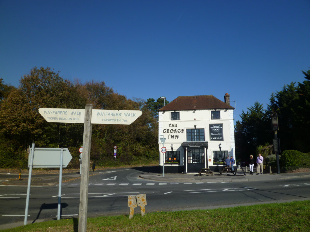
After the gentle uphill walk out of Cosham and through the parkland towards the A3/B2177 crossroads I resumed the Wayfarers’ Walk by the George Inn. I was a little worried about this section, which, according to the map, leads along the busy road all the way to Bedhampton in the built-up Havant area. However, it was possible to, at first, walk along the northern edge of the park (with some good views of Langstone Harbour and Portsmouth) and then along a grassy hedged path and track up to Fort Purbrook (now an activity centre). After taking in the fantastic views from up here, I followed the footpath around the Fort, which was wonderful because from up here there were views across a golf course to the North, including the South Downs, and it was nice to give the eyes a break from the glare of the sun. After the fort I continued the walk along a path parallel to but higher up from the road which led past paddocks and grazing horses to another fort (now a fenced industrial zone). Here that footpath ended as it followed the fence down to the road. I now had no choice but to walk on the pavement on the road leading to Bedhampton – crossing the A3(M) along the way.
I was extremely pleased to turn away from the road when my route turned right into a recreational area – not least because I was quite hungry now and ready for lunch! There was an old church here and, after walking around it, noting the extremely old yew tree, I sat in the shade of a tree for a moment’s reflection, relaxation and to savour my sandwich.
Autumn is wonderful for walking and I took the opportunity of a beautiful Sunday to complete the Wayfarers’ Walk. I travelled early as the journey involved a couple of train changes. It all went smoothly and I started the walk from Cosham Station in bright sunshine. That sunshine was staying with me all day, which was lovely but not so good for taking photos.
After the gentle uphill walk out of Cosham and through the parkland towards the A3/B2177 crossroads I resumed the Wayfarers’ Walk by the George Inn. I was a little worried about this section, which, according to the map, leads along the busy road all the way to Bedhampton in the built-up Havant area. However, it was possible to, at first, walk along the northern edge of the park (with some good views of Langstone Harbour and Portsmouth) and then along a grassy hedged path and track up to Fort Purbrook (now an activity centre). After taking in the fantastic views from up here, I followed the footpath around the Fort, which was wonderful because from up here there were views across a golf course to the North, including the South Downs, and it was nice to give the eyes a break from the glare of the sun. After the fort I continued the walk along a path parallel to but higher up from the road which led past paddocks and grazing horses to another fort (now a fenced industrial zone). Here that footpath ended as it followed the fence down to the road. I now had no choice but to walk on the pavement on the road leading to Bedhampton – crossing the A3(M) along the way.
I was extremely pleased to turn away from the road when my route turned right into a recreational area – not least because I was quite hungry now and ready for lunch! There was an old church here and, after walking around it, noting the extremely old yew tree, I sat in the shade of a tree for a moment’s reflection, relaxation and to savour my sandwich.
 Chichester Harbour and Hayling Island
Having walked more or less in the same direction so far, the next mile or so proved a little bit more challenging with regard to route location. The map was essential here as the walk led to and across, then underneath and along railway tracks, before reaching an industrial zone and crossing the A27. Tranquillity returned when the route (and there was even a Wayfarers’ signpost here) followed a delightful path along a little stream leading all the way down to Langstone Harbour. I dug out my binoculars and enjoyed getting close-ups of the seashore birds. Must get better at recognising birds! It really was wonderful walking along the harbour. The atmosphere was a little hazy, the tide was retreating, and this may not be the most picturesque stretch of coastal walking, but the clearly visible Portsmouth skyline and the variety of seashore and other birds made the walk a treat.
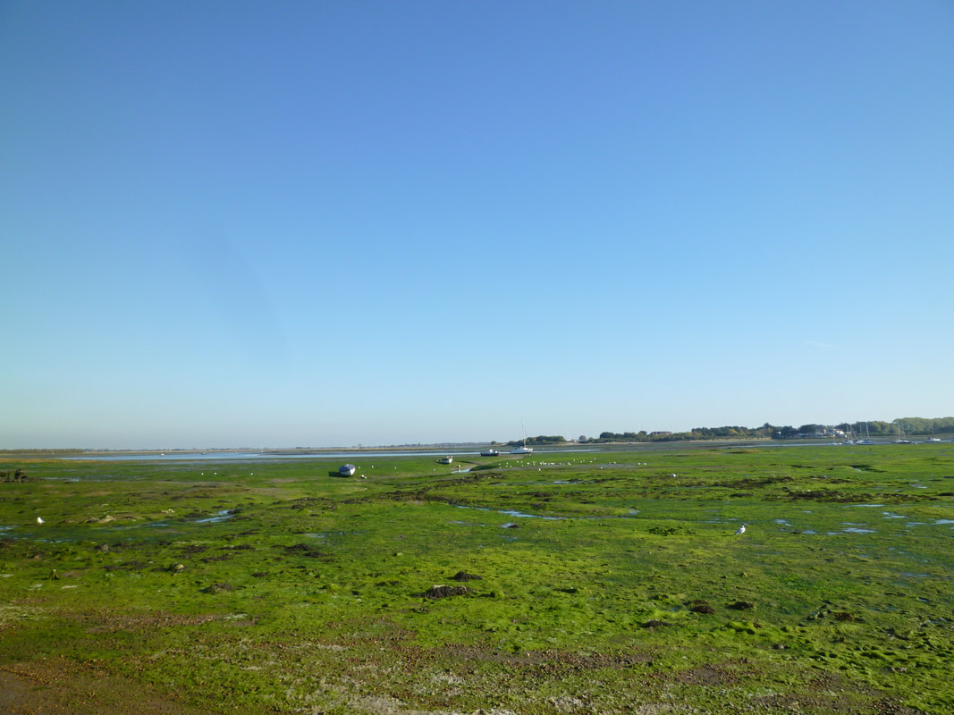
A water inlet at Langstone meant leaving the shore for a while and, after crossing the water on a footbridge and walking through the village, the route returned to the coast by the popular Royal Oak pub. From Langstone a road leads to Hayling Island and it is here, I think, that Langstone Harbour ends and Chichester Harbour begins. Lots of people were out and about here, walking, cycling or enjoying a drink outside the pub. The tide was still out but the green algae covered ground with watery channels and lagoons made for an attractive foreground to the blue sky and distant sailing boats. I stopped briefly by the mill pond with its ducks and swans to enjoy the scenery and atmosphere before the final stretch of the walk to Emsworth. Soon the path veered away from the coast as it followed the Church Path to St Thomas Church and through the vast cemetery at Warblington. Quite emotional to see all the lovingly tended children’s graves here as the path leads straight through this section.
Continuing along the Church Path, first along a hedge and then a woodland edge, I soon reached the final stretch of coastal walking in Emsworth. This small town is a fitting end to the walk. It is a vibrant town in a lovely setting and has a train station. I know that I will return here one day. Perhaps on a walk along the newly created England Coast Path?
My highlights
Transport:
- Views across Langstone Harbour
- Walking along Langstone and Chichester Harbours
- Cackling seabirds enjoying a meal in the retreating tide
- Arriving in Emsworth to complete the Wayfarers’ Walk
- Gulls, waders and other seashore birds
- Noisy starlings, wagtails and other unidentified birds
- Deer (spotted from the train window)
- Horses, cows and sheep
Transport:
- Train Reading to Cosham (changed at Guildford and Havant)
- Return: Train Emsworth to Reading (changed at Southampton).
- Reading, Guildford, Havant and Southampton train stations
- Cosham
- Bedhampton/Havant
- Langstone
- Emsworth
- Train stations
- Emsworth
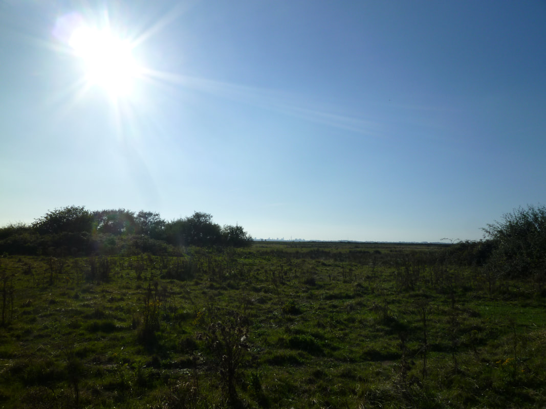
View across South Moor towards Portsmouth
|
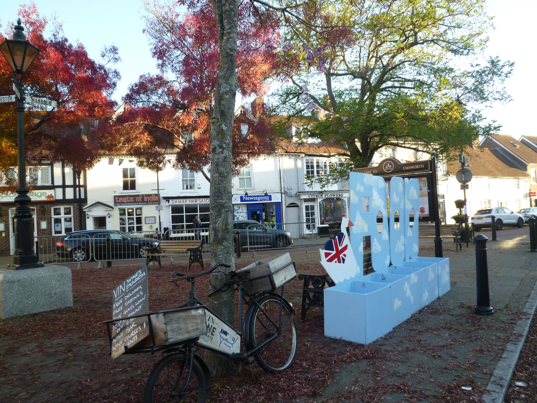
Emsworth
|